
Walk a Clackamas County Street by Address
The useful question is not whether one online screen lists a whole street. Clackamas County keeps different parts of the answer in different places. CMap normalizes an address and supplies parcel, taxlot, jurisdiction, district, map, and document context. It does not display property-owner names online. Assessment & Taxation is the county-designated contact for that separate layer, while the Recording Division holds the formal title trail. A permit record can place work or a project at an address, but its applicant does not establish who owns or occupies the parcel.
- Enter the address in CMap and save the standardized address, city or county jurisdiction, taxlot or account context, and any map or plat lead.
- Contact Assessment & Taxation for owner information that the public map does not publish. Keep a mailing address separate from the physical address.
- Take the party name, legal description, or instrument reference to the Recording Division's public research area for the conveyance trail.
- Check the map jurisdiction before using an address-based permit route. County tools serve unincorporated areas, while incorporated addresses can belong to a city system.
- Use a dated directory, tax roll, or a lawful voter-list request only as evidence for its particular time and legal scope.
Each source answers a narrower question. That is more dependable than treating a map click as proof of a complete street roster.
Clackamas County Street Map Fields
CMap has five autocomplete modes: Address, City, Parcel Number, Street Intersection, and Taxlot Number. Address is the default, and an incomplete entry can return suggested matches. For a street segment, the intersection mode accepts a format such as Kenny St & Lakeview Blvd; a comma and jurisdiction can refine it. Parcel numbers use eight digits with leading zeroes, while taxlot searches omit display dashes. After a selection, CMap groups information under Assessment, Schools, Public Safety, Zoning & Development, Voting, Utilities & Districts, Environmental & Hazards, Parks, and Documents.
| CMap field | Entry type | Street-search use | Format note |
|---|---|---|---|
| Address | Autocomplete text | Find a mapped address | Partial typing returns suggestions |
| City | Autocomplete text | Refine place context | Damascus is not offered as a city option |
| Parcel Number | Autocomplete text | Open parcel context | Eight digits; leading zeroes matter |
| Street Intersection | Autocomplete text | Start a street segment | Use cross streets, then jurisdiction if needed |
| Taxlot Number | Autocomplete text | Bridge map and land records | Use map number and lot without display dashes |
CMap can show nearby parcel geometry and useful district layers, but its boundary display is not survey quality. The county directs boundary questions to a licensed surveyor.
Note: The map supports location research, not a public online owner-name or household directory.
Clackamas County Street Tax Accounts in Ascend
AscendWeb is the county property-address interface. It offers an eight-digit Account Number or Alternate Map Account Number route, and an address route with Street Address required. City, State/Province, and Zip/Postal Code are optional refinements. A percent sign can sit between the number and street name, so entries such as 123% Main are supported. The optional ZIP field can narrow an address search, but it does not settle a city boundary or identify an occupant.
| AscendWeb field | Requirement and use |
|---|---|
| Account Number | One route; use exactly eight digits. |
| Street Address | Required for an address search; supports a percent wildcard between number and street. |
| City | Optional address refinement. |
| State/Province | Optional address refinement. |
| Zip/Postal Code | Optional address refinement, not proof of jurisdiction. |
The county Value History screen instead accepts an account number or address and displays real market value and maximum assessed value history where a graph is available.
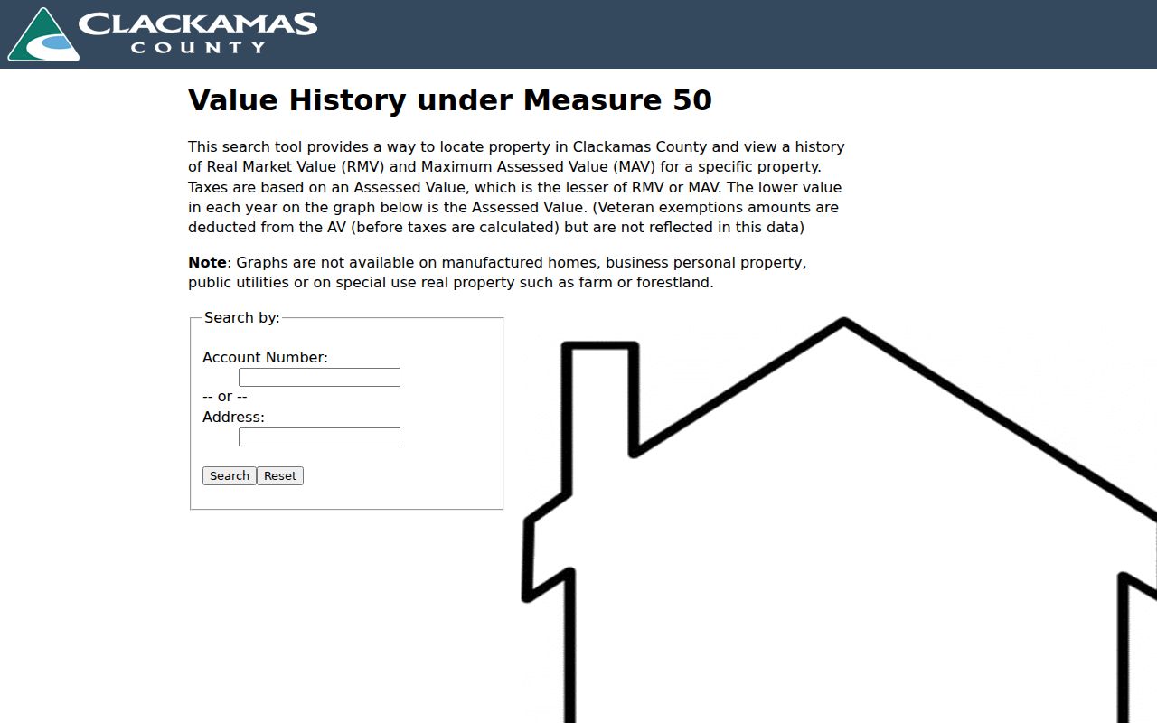
That value-history view supports property context, not a claim about every person connected with an address.
Clackamas County Street Records by Address
Address-keyed records have different strengths. A parcel map locates land. Assessment records supply tax context and an office route for owner information. Recording preserves instruments and legal descriptions. Planning files and city permits describe development under the agency with jurisdiction. Older tax rolls and directories can add a dated snapshot. The table keeps those layers distinct, which matters when a Clackamas County street crosses from an incorporated city into an unincorporated area.
| Address record | Custodian | What it can show | Access path |
|---|---|---|---|
| CMap selection | County GIS | Address, parcel context, layers, maps, jurisdiction | Free online autocomplete; owner names absent |
| Value History and tax context | Assessment & Taxation | Value history and tax/property context | Online by account or address; owner route by office |
| Recorded instruments | Clerk Recording Division | Parties, title trail, legal description, plats | Public research area, phone, and copying route |
| Planning and land-use files | County or city with jurisdiction | Subdivision, partition, zone, or conditional-use context | County historic holdings or the responsible municipality |
| Historic tax rolls and directories | Archives and local collections | Dated owner or published household evidence | Archive, library, microfilm, or catalog route |
For a county-held document that is not otherwise available, Records Management routes Oregon Public Records Law requests. Give the address, date range, department, document type, and preferred delivery form. The county acknowledges requests within five business days, but access and actual-cost charges depend on the record and applicable exemption.
Clackamas County Street Deed Index Reels
A street address rarely supplies the full historic land trail by itself. The recording standards require a legal description, such as a subdivision with lot and block, metes and bounds, or a reference to an earlier recorded instrument. The Clackamas County Clerk says ownership can be traced to the early 1850s and maintains a public research-and-copying area at 1710 Red Soils Court, Suite 110 in Oregon City. Current recordings are indexed within two business days, but the county did not verify a complete public online grantor-grantee search form.
The archive inventory supplies the useful date ranges: the Direct Deed Index spans 1851 to 1969 on 43 microfilm reels, the Indirect Deed Index continues to 1972, and electronically indexed and imaged Recording Office instruments begin in 1989. Use a current party and legal description to find the conveyance, then treat the prior grantor as the next earlier grantee. Keep the instrument number, recording date, legal-description wording, and book or page reference together.
The Recording Division fee schedule lists a copy or research request at $3.75 plus 25 cents for the first page and 25 cents for each additional page. Certification is listed at $3.75.
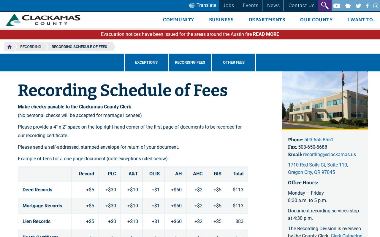
Those are research and copy figures. They are different from the fee for recording a new instrument.
Clackamas County Street Permits by Jurisdiction
First use CMap's Jurisdiction group. County Planning administers zoning and land use in unincorporated Clackamas County, while an address inside a city follows that city's permit system. The county Accela portal covers Building, Code Enforcement, Engineering, Planning, and Septic categories for records after January 1, 2016. Its historical document retriever is a separate route for Permit Number, Address, or Taxlot searches. Neither route makes a permit applicant proof of ownership or residency.
The county Accela search shows its address-oriented permit categories for unincorporated areas.
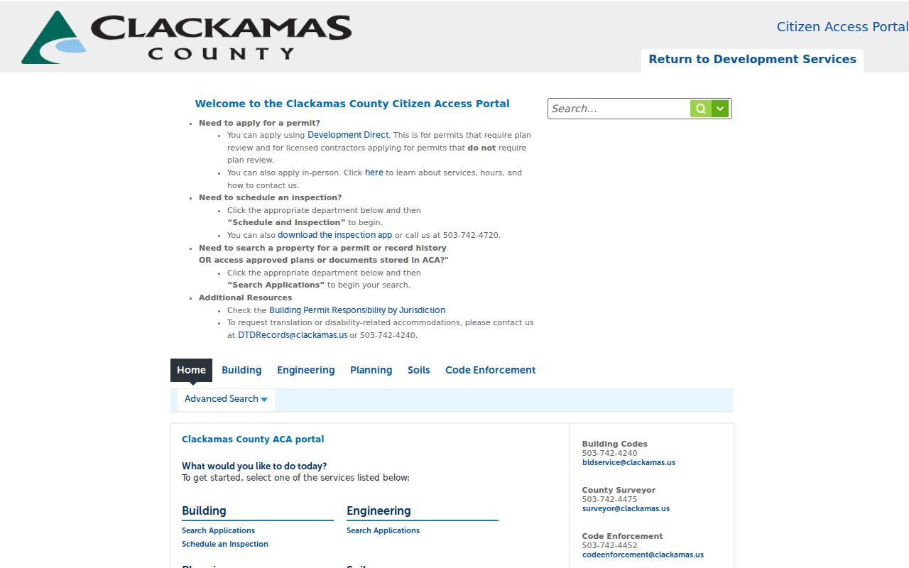
Use the result as a project or land-use lead, then confirm the responsible agency and record scope.
The county Document Retriever accepts Permit #, Address, and Taxlot and can return Permit #, Address, Taxlot, Applicant, and Actions.
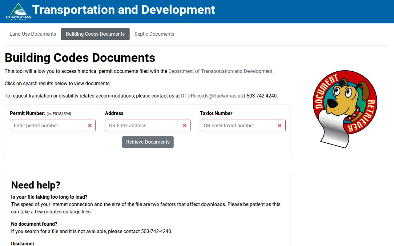
The county cautions that its data are not wholly digitized; use DTDRecords@clackamas.us or 503-742-4240 when a needed item is missing.
Oregon City Building and Construction directs city-address searches to its municipal records route, including public final and current records back to 2002.
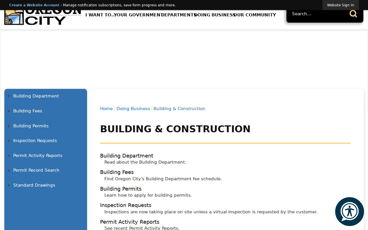
A municipal screen is useful only after CMap confirms the address is within that city.
Oregon City's self-service permit portal is the corresponding online search route.
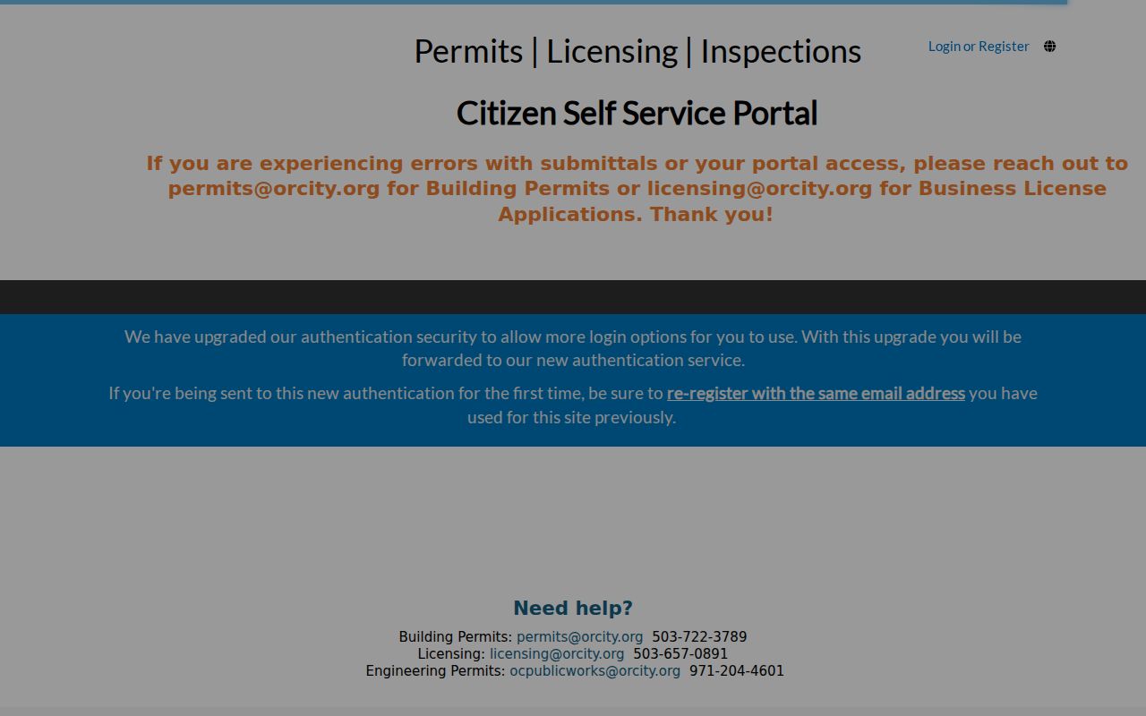
Postal city labels can mislead. Canby warns that a rural address using its postal name can still be in unincorporated county jurisdiction.
Clackamas County Street Labels That Changed
Old address research needs more than a suffix change. CMap does not offer Damascus in its City mode because Damascus is no longer a city. A former place label, taxlot, cross street, plat, or legal description can bridge that change. Oregon City's historic-property record also documents one specific renumbering: 503 High Street was renumbered in 1916. That example is a clue for that address, not evidence that every county street was renumbered.
- Parcel
- A mapped unit of land used for assessment and map context.
- Situs address
- The physical street location used to find a property on a map.
- Plat
- A recorded map that can identify a subdivision, lot, block, or related land reference.
- Legal description
- The formal land wording used in recorded instruments, not merely a tax account or postal address.
- Criss-cross directory
- A reverse-style directory arranged by address when a verified volume exists.
For a dated household clue, consult the verified historical collections described in the Clackamas County city directory material rather than assuming a current map reflects an earlier address.
Clackamas County Street Snapshots in Print
Address evidence in a historic volume is a dated snapshot, not proof of a current connection. Oregon City's documented local directory leads include Sohns & Woodbeck's Clackamas County and Oregon City Directory from 1917, Pacific Directory Service's Directory of Oregon City from 1941, and its Directory of Clackamas County from 1948. The runs are identifiable, but no continuous countywide reverse-directory run was verified. Pair a street entry with its exact year, city or rural setting, and the original spelling.
Oregon City Public Library's Oregon Collection is a reference-only local-history stop with books, periodicals, and Oregon City High School yearbooks from 1910. Its catalog and staff route can help locate a relevant volume when there is no public full-text scan. The State Archives guide and the Clackamas County Family History Society add separate archive and local-research paths.
Old directories complement the county street directory process because they date a published address. They do not establish current ownership, a full household, or a present delivery address.
Clackamas County Street Voting Context
CMap can show precinct and district context for an address. Oregon's personal My Vote service is different: it is for a voter to check or update that person's registration with name and date of birth. It is not a public street-browse tool. A voter list is instead a statutory request channel, and protected-address records remain excluded.
Under ORS 247.948, allowed voter-file fields can include name, party affiliation, residence address unless protected, year of birth, precinct information, telephone, and participation fields. Birth month and day, Social Security number, driver-license number, and signatures are closed. Clackamas Elections handles county scope and hardcopy routes; the Oregon Secretary of State handles electronic statewide or less-than-statewide requests. A requested list has delivery, fee, and use conditions, including a prohibition on commercial use.
Note: A precinct can help choose an election office path, but it does not identify a current household.
Clackamas County Street Privacy Limits
No verified county source offers a public list of everyone connected with a street. CMap excludes owner names online, recording identifies formal document parties, and map boundaries are not survey quality. Utility customers, delivery recipients, and all people in a household are not presented as a public county street roster. Protected voter addresses and Address Confidentiality Program records are excluded from available voter-list channels.
Lawful use. Use Clackamas County address records for lawful personal research and confirm important facts with the custodian. Do not use names, addresses, or map details to stalk, harass, intimidate, or harm anyone.